Home away from home!

Home away from home!
Best viewed using Chrome

Introduction

We are off to.... is our Blog to allow family, friends, and others that are interested to follow us on our extended RV travels.

We aren't full time RVers but like to take extended trips of a month or more as often as we can. We prefer public agency campgrounds like State and National Parks, US Forest Service, etc. We do use some RV Parks if they are the closest or most convenient place to things we want to see or do.


We will attempt to provide information on the various campgrounds we stay in, things to do in the area, and pictures of what we see.

Tuesday, July 3, 2018

Flaming Gorge and Dinosaur National Monument

On Sunday we moved from Warren Bridge, WY to Green RIver Campground in Dinosaur National Monument.  Our route took us down US 191 on the east side of Flaming Gorge.  Taking the west side via a state route would have been much better for view of the reservoir but the road may have been more difficult towing.  Missed opportunity or good decision we won't know.


First view of Flaming Gorge reservoir.  It is 91 miles long stretching from Green River, WY to south of Dutch John, UT.


Flaming Gorge Dam


View from the Visitor Center


Green River Campground doesn't have any hookups, in fact the only water is a single spring loaded faucet at the drinking fountain at most restrooms.  We were aware of no hookups as we are self contained and have ample solar charging capability but we didn't count on the heat.  It was 95 degrees and dropped to the high 60's at 3-4 in the morning.  Without AC power we had no air conditioning.  Ugh!!!!


The view from our campsite was nice but the heat was too much for sleeping.  Monday morning after several calls we got a site at the KOA in Vernal.  Not a favorite of mine but AC power was the most important.  Turned out to be a fairly nice campground.  We weren't the only ones that decided to leave.  By the time we left the campground was nearly empty.


After getting situated in our new site we returned to the Monument to visit the Visitor Center and take the shuttle to the Quarry Hall.


Inside the wall was the partially excavated deposits of dinosaur bones as they were exposed at various levels.


Bones from this area are on display at multiple museums across the country, Canada and Europe.


Ranger led tour of the area of the quarry.  Not a trail we were ready to take even if it had been cool.


Overlook from the Quarry shuttle stop area.


After visiting the Quarry we drove to the Split Mountain area that has a boat launch (rafts and kayaks) and small campground.  Again no hookups, power or water other than at the restrooms.  Most campers had multiple 5 gallon water jugs.


Green River downstream from the campground.  By evening we smelled smoke and the skies to the west were gray with smoke.  


When we got up Tuesday there was ash all over everything.  The fire was about 75-100 miles west of us near Strawberry reservoir and last report was 7000 acres.  

Update: by Tuesday evening the fire had grown to 30,000 acres and growing.

We went back into the Monument but this time at the Dinosaur, CO entrance.  From there you take a 31 mile road to Harper's Corner that overlooks part of the Green River Canyon.  Different scenery with high elevation and Juniper covered terrain. 


Vista point along the road.


Another vista point


View of the canyon at the end of the road.  Most of the area was between 7600-8300' elevation.  Because were were further away from Vernal and there was a nice breeze it wasn't nearly as smoky.


The best  view so far for Linda was when we came upon a small band of wild horses with colts.  There were about 8 or so in the band.  It was right beside the road and they weren't spooked as we drove by slowly.

A couple short videos Linda took.


Of course Linda managed to find another quilt shop to visit in Vernal.  She will have to do a Quilt Shop Travelogue so others can find places to spend their money.

Tomorrow we move to North Salt Lake City to visit old friends in the area and attend a family reunion at one of my niece's homes in North Ogden, UT.  On Sunday we will start for home taking two days.  

This will likely be our last post until the next trip.


Saturday, June 30, 2018

Warren Bridge Campground, Pinedale, WY and Wind River Range


Friday We moved to Warren Bridge BLM Campground that is about 20 miles north of Pinedale, WY.  The campground is on the banks of the Green River at 7600' elevation.  It is on a high plateau with the Wind River Range on the north, the Wyoming and Salt River Range to the southwest and the Gross Verdes and Snake Ranges to the northwest.  All have snowcapped peaks.

The drive over took us along the Snake River which we left last week in Idaho/Oregon.  So we have seen where the Snake joins the Columbia, and we have seen it across southern Idaho/Oregon on past trips.  We also floated the Snake in the Tetons several years back. It is truly a Snake, running south, west, north, south, west, north, west, south and then west again before joining the Columbia.  On the stretch along Palisades Reservoir there were Osprey nests on almost every power transmission poles/towers.  Fishing in the reservoir must be good.

There is an Osprey nest just across the river but we can’t tell if there are chicks in it.  The sheriff came by and talked to Linda and said there are moose in the area.  As there are plenty of willows along the river and wet areas it just may be favorable moose habitat. Later I talked with the host who said he has been with the US Fish and Wildlife Service for 30 years in Colorado.  He said that a bull and a cow wander through from time to time.  We will keep looking for whatever wildlife we can see.

The Green River is about 50 yards or so behind our site.  To the north you can see the Wind River Range.  


There is an Osprey nest across the river and we occasionally saw one of the pair diving or swooping down on the river for fish.  Couldn't tell if successful or not.

Bridge up river is Warren Bridge.


The views of the Wind River Range changed as the sun progressed across the sky.


View of the range in the evening.

Saturday we drove to Pinedale to check it out, do some laundry, and of course visit a quilt shop.  After Picking up some things at the grocery store we did the laundry.  Next it was the quilt shop where as required, Linda found something to buy.

No moose so far but there were a number of antelope between our campground and Pinedale.  Too far off for pictures.  Much of the highway is fenced on both sides to keep them off the highway.  Every so far there is an under or over pass for the wildlife to cross to the other side.
The campground host told us about a drive up past Fremont Lake (named after John C. but he was never there) to the end of the road if we wanted to get a great view of the Wind River Range.  We did and from the pictures you can see just how pretty it is.  The road ended at 9400’ elevation.


This is at 9300' and we continued on to the end of the road at about 94-9500' where there is a trailhead and small campground with a few corrals for horses.


View of one of the side canyons with a number of waterfalls.


The video provides a better look at the views.


Looking down at Fremont Lake.


Fremont and other smaller lakes below.


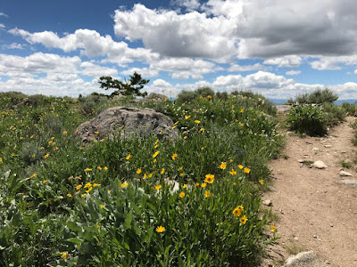
The wildflowers were everywhere.


Video of the Pinedale area which is at 7400'.  As it is a high plateau it is deceptive and doesn't seem that high except when catching your breath.


Wednesday, June 27, 2018

Quilt Shop, Challis Hot Springs and Stanley Lake

On Tuesday we moved from Lolo to Challis Hot Springs just south of Challis, ID.  We made a stop in Salmon, ID and you can guess what for.  The next picture may be a clue.  As it was Linda's birthday I couldn't refuse.


The hot spring pools are across the grassy area near the office and B&B.  The small pool is 107 degrees and the large pool is 102 degrees.  Most use the large pool and we may try it this evening.


Our site at Challis Hot Springs is under a large Cottonwood tree that provides nice shade during the day.


The Salmon River is right behind the campground..


Nice but the mosquitoes are thick as the sun starts to go down.  


Wednesday we took a drive up the Salmon River to Redfish Lake which is its source.  Nice lake but everyone and their relatives were there.  It was crawling with people.  The drive along the Salmon River was beautiful and we made a number of stops to take pictures and enjoy the views. 


As we approached the town of Stanley we got a magnificent view of the river and the Sawtooth Mountains.


Like I said Redfish Lake had too many people for my liking so we traveled west to Stanley Lake.  I had seen pictures of it on a blog I follow and it was stunning. Several campgrounds but it looked like only one that could accommodate our trailer.  It was nice though.


In the left of the video you can see a fisherman that had just tried to land a big fish.  His net was a little small and the fish got away.


On our way back we stopped near the little village of Sunbeam,  It was on the fork of the river where several mines were operated.  There are the remnants of the old dam across the Salmon River that washed out many years ago.


Linda checking out the view below the old dam.


Monday, June 25, 2018

Campground, Big Hole Battlefield National Historic Site, and Last Bus to Wisdom

We really like the Square Dance Center and RV Campground.  There are 22 Full Hookup 50 amp sites with at least another 8-10 30 amp and a number with electric and water.  In total it looks like at least 70 sites.  There is ample spacing between sites that are scattered among the pine trees..  Lolo Creek is behind the park with trails for pleasant walks.  There is even an 18 hole Wiffleball golf course.

The park is convenient to Lolo for shopping, restaurants and fuel.  It is just 8 miles south of Missoula and a gateway to the Bitterroot Valley.


Behind the campground along Lolo Creek.


Our site


Nearby sites


The Battlefield and Wisdom are on Hwy 43 east of US 93 at the end of the Bitterroot Valley.  Hwy 43 is at Lost Trail Pass at 7100 feet, and the Idaho border.  From there you immediately climb over Chief Joseph Pass on Hwy 43.


The Big Hole Battlefield has been on my list of places to visit for a long time.  I read histories on Chief Joseph and the Nez Perce when I was in High School,  In my travels for business I visited the Bear Paw site where Chief Joseph and a small band of women and children were surrounded and captured.  That site is just 40 miles south of Canada which they were trying to reach after many skirmishes with the Army over 1700 miles from their homeland in the Wallowa Valley of Oregon.

We have spent time in the Wallowa Valley several times in the last 5 years and learned much about the history.   There are several books that detail the history and are well worth reading.


The Big Hole looks like a large bowl or hole in the mountains that surround the high valley. 

Now I will let Linda take over and explain the book below and the need to visit Wisdom.


This may be my one and only contribution to the blog on this trip.  It all began with a book my friend Mary Lue loaned me, shown below.  When Glen saw the book he asked me if it had anything to do with Wisdom, Montana.  I told him I didn't think so, although much of the book is set in Montana.  I figured the title referred to the wisdom the protagonist of the story gained on his trip traveling the country via Greyhound Bus.  Well, I was only half right.   It happens to be about both wisdom gained and the destination to Wisdom, Montana.  I just HAD to see what this little town was like.  


Welcome to Wisdom, Montana, population 108, down from 382 in 1942.

Thank you, Mary Lue, for the loan of this delightful book.